rangersac
Medically diagnosed OMS
Sick of machine built flow trail, massive berms, and pump tracks, and like to earn your turns? Then Coningham is the place for you!
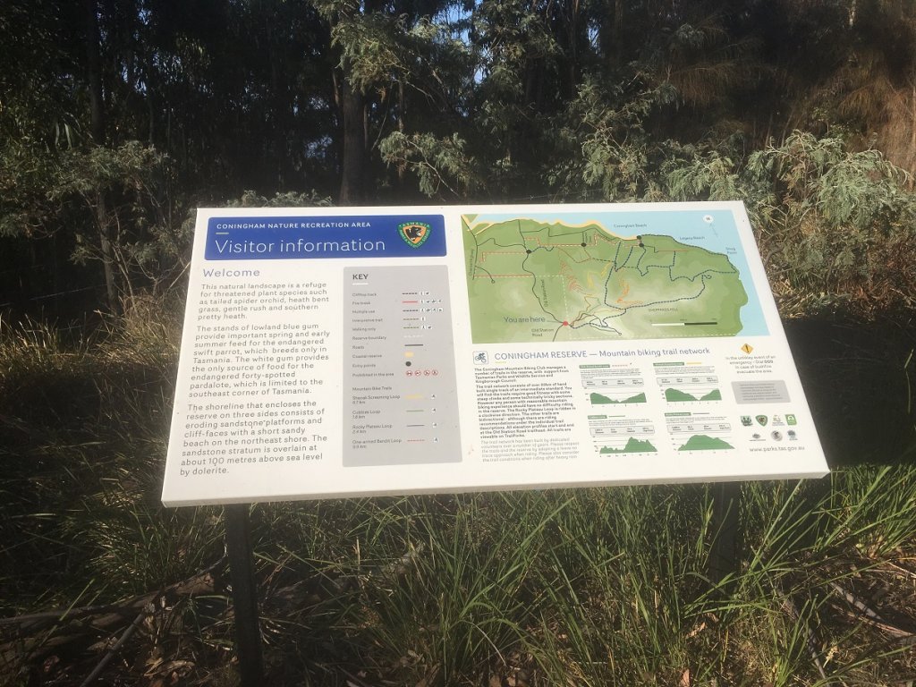
This project has been a while in the making but thanks to Kingborough Council funding, an agreement with Parks and Wildlife, and a super enthusiastic bunch of locals at the Coningham Mountain Biking Club, there's now around 20km of signed trails in Coningham recreation reserve, 30 minutes drive south of Hobart. The trails are laid out in four loops from a starting point at Old Station Rd, however the reserve does have several other access points with fire trails linking up the network.
Tracks are all hand built and mostly XC with a few technical light enduro features, so it's all rideable on a hard tail, but a full susser trail rig will give the biggest smile. As noted though there's no avoiding the climbing to earn your fun, the longest loop clocks in at almost 10km with 350m of elevation gain, whilst the full 20km network will see you climbing over 700m
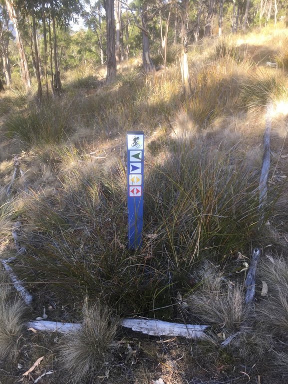
Signage pics below, and feel free to PM me if you'd like more info. The network is all on Trailforks and can also be found in the Tasmania Mountain Biking Guidebook. Also embedded is a video from their youtube channel although this was recorded before the signage network was installed.
This project has been a while in the making but thanks to Kingborough Council funding, an agreement with Parks and Wildlife, and a super enthusiastic bunch of locals at the Coningham Mountain Biking Club, there's now around 20km of signed trails in Coningham recreation reserve, 30 minutes drive south of Hobart. The trails are laid out in four loops from a starting point at Old Station Rd, however the reserve does have several other access points with fire trails linking up the network.
Tracks are all hand built and mostly XC with a few technical light enduro features, so it's all rideable on a hard tail, but a full susser trail rig will give the biggest smile. As noted though there's no avoiding the climbing to earn your fun, the longest loop clocks in at almost 10km with 350m of elevation gain, whilst the full 20km network will see you climbing over 700m
Signage pics below, and feel free to PM me if you'd like more info. The network is all on Trailforks and can also be found in the Tasmania Mountain Biking Guidebook. Also embedded is a video from their youtube channel although this was recorded before the signage network was installed.


