Hi All,
In my role as trail development officer I just wanted to ask for Toowoomba area
mtb'ers assistance with something fairly important.
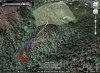
We are currently negotiating with council to make Cheeseburger a legal trail, protect its character
and maybe even make it longer. But in a way that makes it acceptable to
council, and meets their requirements.
While we engage in this process, it is important that mountain bikers -- members or not --
refrain from further trail building at this site. Maybe get involved with the other legal building efforts.
The key here is that Cheesburger is currently an illegal trail. If we want to get council on side
we need to be doing the right thing.
We understand your enthusiasm, and look forward to your contributions if we can be
successful in these negotiations!
Kind regards
Matt
In my role as trail development officer I just wanted to ask for Toowoomba area
mtb'ers assistance with something fairly important.
We are currently negotiating with council to make Cheeseburger a legal trail, protect its character
and maybe even make it longer. But in a way that makes it acceptable to
council, and meets their requirements.
While we engage in this process, it is important that mountain bikers -- members or not --
refrain from further trail building at this site. Maybe get involved with the other legal building efforts.
The key here is that Cheesburger is currently an illegal trail. If we want to get council on side
we need to be doing the right thing.
We understand your enthusiasm, and look forward to your contributions if we can be
successful in these negotiations!
Kind regards
Matt