The Self Sufficient Bike Camping Thread.
- Thread starter Dreggsy
- Start date
Elbo
pesky scooter kids git off ma lawn
Oh, by the way… the Surly Troll is now finished 
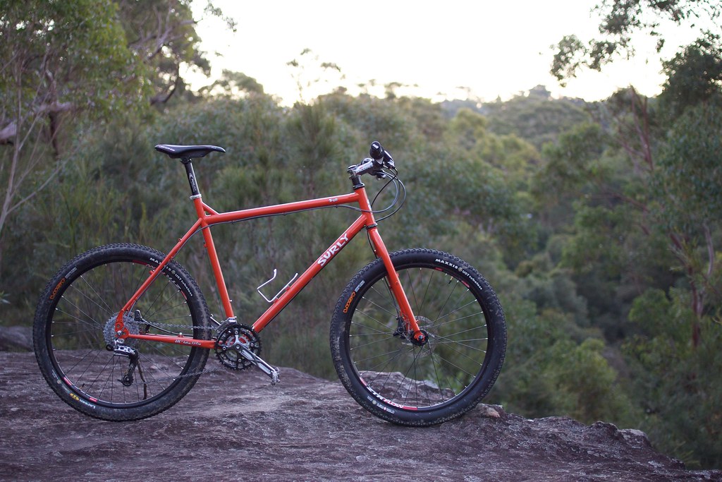
Now I'm just starting to get my fitness back after not having a bike for a few months while building this one. Did 80km on bike paths and firetrails last week. Will probably look to get racks and panniers and suitable sleeping bag and tent in a few months. No big trips planned yet, but have got a couple of weeks set aside to do something after 2nd semester at uni finishes for the year.
Now I'm just starting to get my fitness back after not having a bike for a few months while building this one. Did 80km on bike paths and firetrails last week. Will probably look to get racks and panniers and suitable sleeping bag and tent in a few months. No big trips planned yet, but have got a couple of weeks set aside to do something after 2nd semester at uni finishes for the year.
Have you been to anywhere interesting lately?
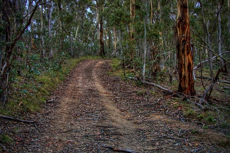
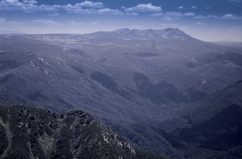
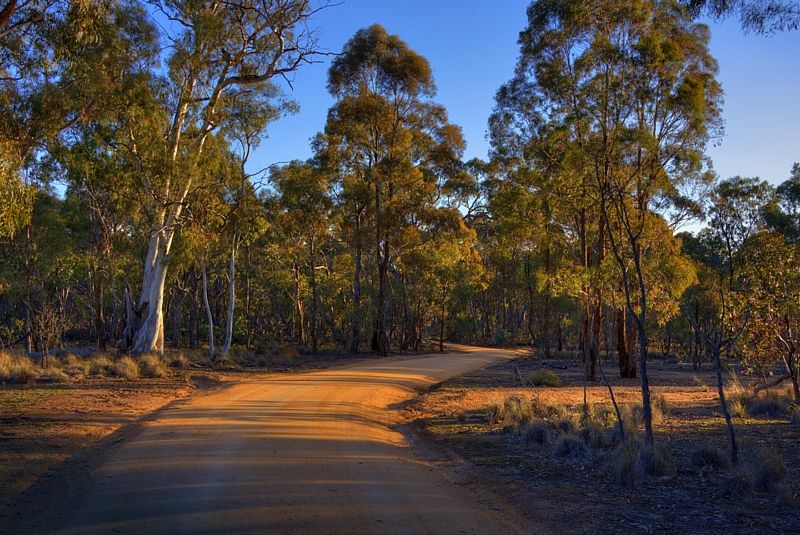
I went and had a squiz into the Naas River Valley from the Booth Range ... and then went down to Brayshaw's Hut. Please view the first dozen and a half images from my recent trip.
The changes to this site? don't appear to allow me to download images ... from my Photobucket archive now, sadly.
http://s225.photobucket.com/albums/dd301/WildWassa/
Warren.
SummitFever
Eats Squid
Awesome pics Wildwassa.
Rode out to Mt Gingera a couple of weeks ago. Things were pretty cold above 1800m shrouded in cloud and surrounded by snow. Brindabella Road and Mt Franklin Rd were in good condition, but I think they might both be closed now because of more snow.
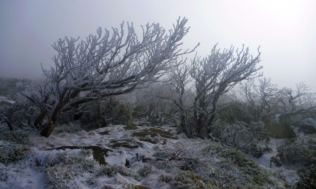
Rode out to Mt Gingera a couple of weeks ago. Things were pretty cold above 1800m shrouded in cloud and surrounded by snow. Brindabella Road and Mt Franklin Rd were in good condition, but I think they might both be closed now because of more snow.
Elbo
pesky scooter kids git off ma lawn
Great photos as usual Wassa. I'm interested to know what focal length you were using for the Emu pic? It's fantastic!
Now you've had a few trips with the 'third wheel', what do you think of it?
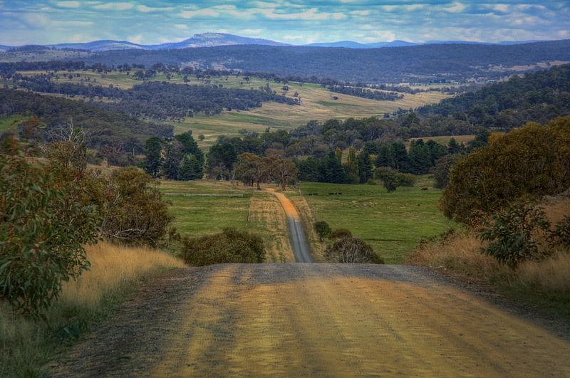
On another note, I'm starting to plan a trip to do at the end of this year. The basic plan is to take 2 weeks and do something like this (see attached). Start at Sydney, ride the coast and then the Eastern side of the Great Dividing Range until level with ACT, then cross to maybe Jindabyne, Thredbo then Corryong and then finish at Albury. Aim is to stick to dirt as much as possible, but I don't want 2 weeks to turn into a month of pushing up steep ridges the whole way, so I'm happy to stick to some more road style touring on back country dirt and quieter type roads. Would be good to hear from others who have ridden this part of NSW, places of interest, great views, hills to avoid, etc. Thanks!

Now you've had a few trips with the 'third wheel', what do you think of it?
On another note, I'm starting to plan a trip to do at the end of this year. The basic plan is to take 2 weeks and do something like this (see attached). Start at Sydney, ride the coast and then the Eastern side of the Great Dividing Range until level with ACT, then cross to maybe Jindabyne, Thredbo then Corryong and then finish at Albury. Aim is to stick to dirt as much as possible, but I don't want 2 weeks to turn into a month of pushing up steep ridges the whole way, so I'm happy to stick to some more road style touring on back country dirt and quieter type roads. Would be good to hear from others who have ridden this part of NSW, places of interest, great views, hills to avoid, etc. Thanks!
DaGonz
Eats Squid
I can get you from Blackheath to Bomaderry and maybe back into Canberra on Dirt. You could dot it with dirt sections all the way from Emu Plains. Alternatively, once you're at Wombeyan caves you can just head SW to Canbberra. From Canberra to Batemans Bay is then doable all on dirt. Depending on your mileage, that's 3 days riding so far.Would be good to hear from others who have ridden this part of NSW, places of interest, great views, hills to avoid, etc. Thanks!
View attachment 205508
If you didn't want to go down the coast, Canberra to Kozi and onwards through to Victoria is a doddle... as far as finding an off road route. Wassa would have routes for this, as do many others. You can basically follow the BNT as a worse case.
Cheers
Spoonie
Elbo
pesky scooter kids git off ma lawn
Thanks Spoonie, I was thinking of perhaps going down the coast until Nowra then starting to come inland crossing near Ettrema Gorge (as I'd like to see that) and either go down the Eastern side of ACT, then onto Cooma, Jindabyne and Kozi, or go into Victoria and then head North West over the mountains through Benambra or Omeo then Falls Creek. Otherwise I would try and get as much dirt in as possible before Jindabyne and then ride the road from Thredbo to Khancoban and then along the Murray River to Lake Hume and Albury.I can get you from Blackheath to Bomaderry and maybe back into Canberra on Dirt. You could dot it with dirt sections all the way from Emu Plains. Alternatively, once you're at Wombeyan caves you can just head SW to Canbberra. From Canberra to Batemans Bay is then doable all on dirt. Depending on your mileage, that's 3 days riding so far.
If you didn't want to go down the coast, Canberra to Kozi and onwards through to Victoria is a doddle... as far as finding an off road route. Wassa would have routes for this, as do many others. You can basically follow the BNT as a worse case.
Cheers
Spoonie
Starting in the Blue Mountains would be an easy way to clear Sydney and get some nice riding in.
I'm not sure how my pace will be, but would plan to cover between 50-100km per day depending on the terrain with a couple of rest/exploring/photographing days in-between.
If you have any route files I could view in Google Earth I would appreciate it. I have the NobMob Google Earth database downloaded if that helps to point out some tracks to look for.
Cheers,
Elbo
DaGonz
Eats Squid
This is the route I took from Blackheath:Thanks Spoonie, I was thinking of perhaps going down the coast until Nowra
If you have any route files I could view in Google Earth I would appreciate it. I have the NobMob Google Earth database downloaded if that helps to point out some tracks to look for.
http://connect.garmin.com/activity/71853016
http://connect.garmin.com/activity/71852926
http://connect.garmin.com/activity/71852848
but I wouldn't go through Dingo Dell again like I did to Mt Werong (day 1). The BNT has a better route which is still mostly dirt road:
http://connect.garmin.com/activity/47443481
if you follow the route from Jenolan Caves road to Mt Werong instead. Or get the BNT books (there was logging going on when I went through so had to take more "road" than I would have otherwise.
From Mt Werong, you can then head to Taralga as I did in the reverse of the last one or Wombeyan caves as I did in the first one pending on if you want to go to the coast or canberra. There's also probably better options from Wombeyan caves to Kangaroo Valley, taking in the wingello/bundanoon forest trails but I chose expediency and had inadequate maps really (I planned at last minute)
Once in Nowra, I'm not sure of your options to get back other than via turpentine road which as far as I understand is a combination of badly sealed and dirt roads but is longish and has limited services for a good 200km's or so from Nowra. I've tried looking for other options but yeah. You might be able to do your way down to batemans bay, then cut back to Canberra via Araluen ala the C2C200 route:
http://connect.garmin.com/activity/68144257
From Canberra, most of the routes I know go from the western side of Canberra down through to the northwest of Kozi. I've mapped routes, but I think others who have actually done (like the aforementioned mr Wassa ) them would probably better to pipe in here. Jason McAvoy might have some on his Wicked Rides blog though
You might have to break out the maps to link together some of the bits I haven't covered. I'd be interested to know what you discover though
Cheers
Spoonie
You can connect Canberra to Nowra via Nerriga Road (Turpentine road is a smooth gravel shortcut from Jervis Bay), through Nerriga and then via Oallen Fords and Cullula roads to Tarago. 3km of gravel on Oallen Fords, the rest is sealed. Between Nerriga and Nowra is now as good and safe a riding road as you'll find anywhere.Once in Nowra, I'm not sure of your options to get back other than via turpentine road which as far as I understand is a combination of badly sealed and dirt roads but is longish and has limited services for a good 200km's or so from Nowra.
There's a hotel at Nerriga. That's under 100km from Nowra. Also, a servo and stuff at Tarago. From there, you're well positioned for Canberra.
You could look at skipping Canberra and heading south via Braidwood and take Snowball road towards Cooma. Limited services that way.... and I have no experience to offer there. Otherwise, head through Canberra, and go south through Namadgi. Boboyan / Old Boboyan roads are a good bet to Adaminaby and towards Cooma with some nice scenery.
If anyone hasn't had a reply from me to any notes that they have sent ... please let me know. I've replied to my mail, but my replies are not appearing in my 'SENT MESSAGES' archive. Apologies if you haven't had a reply from me.
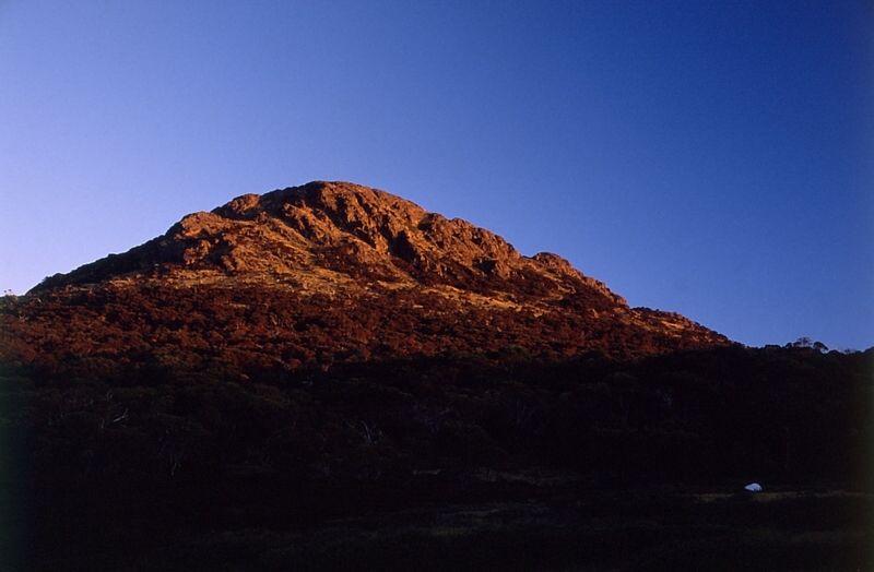
Summit, "Chapeaux au loin." I scored that saying from watching La Tour. If you don't mind me saying, that is a classic shot ... and most chilling to we Canberrans. Poor Snow Gums. The dump was 30cm so I was told.
Elbo, The shot was taken with a 500mm lens with a 2x teleconverter. 1000mm focal length shot at only 4m away from the bird, which was the minimum focusing distance that the lens gave. I rocked backwards and forwards until the highlight in the eyes were sharp. As you can see the depth of field, the acceptable sharp focus is only measured in millimetres.
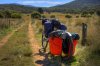
"What do you think of the third wheel?"
I think that I have learned to park the bike very carefully. You just cant stop anywhere. I think that it took me about 10 days riding before I understood the trailer. I think that I've learned to ride very smoothly and think about every possibility that can make the trailer depart. I like how only the cargo affects the ride uphill. Loading the trailer has become a science. I think that I like the trailer ... I think that the trailer has made me a better slow rider. Certainly a stronger rider. You see a lot of country riding around at 8 kph. I do miss going down hill fast. The max speed for the trailer is advised at only 30kph. In loose gravel 20-25 kph is on the limit. The turning circle is usefully tight, but rapid changes in direction to avoid a problem, are not advised. You can't bunny hop with the trailer but the trailer will follow the bike faithfully over a jump.
More replies coming.
Warren.
Summit, "Chapeaux au loin." I scored that saying from watching La Tour. If you don't mind me saying, that is a classic shot ... and most chilling to we Canberrans. Poor Snow Gums. The dump was 30cm so I was told.
Elbo, The shot was taken with a 500mm lens with a 2x teleconverter. 1000mm focal length shot at only 4m away from the bird, which was the minimum focusing distance that the lens gave. I rocked backwards and forwards until the highlight in the eyes were sharp. As you can see the depth of field, the acceptable sharp focus is only measured in millimetres.
"What do you think of the third wheel?"
I think that I have learned to park the bike very carefully. You just cant stop anywhere. I think that it took me about 10 days riding before I understood the trailer. I think that I've learned to ride very smoothly and think about every possibility that can make the trailer depart. I like how only the cargo affects the ride uphill. Loading the trailer has become a science. I think that I like the trailer ... I think that the trailer has made me a better slow rider. Certainly a stronger rider. You see a lot of country riding around at 8 kph. I do miss going down hill fast. The max speed for the trailer is advised at only 30kph. In loose gravel 20-25 kph is on the limit. The turning circle is usefully tight, but rapid changes in direction to avoid a problem, are not advised. You can't bunny hop with the trailer but the trailer will follow the bike faithfully over a jump.
More replies coming.
Warren.
Attachments
-
 101.1 KB Views: 526
Last edited:
Some great shots Warren .Have you been to anywhere interesting lately?
I went and had a squiz into the Naas River Valley from the Booth Range ... and then went down to Brayshaw's Hut. Please view the first dozen and a half images from my recent trip.
The changes to this site? don't appear to allow me to download images ... from my Photobucket archive now, sadly.
http://s225.photobucket.com/albums/dd301/WildWassa/
Warren.
I've been to East Timor for 4 weeks lately which was certainly interesting, but not lots of photography...
Pizzaz
Likes Dirt
As another thought - check out www.advrider.com - specifically the Australian Regional Forum. This is the site for motorcycle adventure touring - theres quite a few threads on there about getting from X - Y all on dirt (I think some of the Sydney - Brissie on dirt stuff looks interesting for a Dirt Brevet style event). Just do a bit of a search - some of the more 'trail bike' specific stuff probably fits the bill for interesting trips with a mix of dirt and singletrackish stuff. Also, they tend to be fuel limited so theres probably small towns / servos etc every couple of hundred kms.Thanks Spoonie, I was thinking of perhaps going down the coast until Nowra then starting to come inland crossing near Ettrema Gorge (as I'd like to see that) and either go down the Eastern side of ACT, then onto Cooma, Jindabyne and Kozi, or go into Victoria and then head North West over the mountains through Benambra or Omeo then Falls Creek. Otherwise I would try and get as much dirt in as possible before Jindabyne and then ride the road from Thredbo to Khancoban and then along the Murray River to Lake Hume and Albury.
Starting in the Blue Mountains would be an easy way to clear Sydney and get some nice riding in.
I'm not sure how my pace will be, but would plan to cover between 50-100km per day depending on the terrain with a couple of rest/exploring/photographing days in-between.
If you have any route files I could view in Google Earth I would appreciate it. I have the NobMob Google Earth database downloaded if that helps to point out some tracks to look for.
Cheers,
Elbo
FatGuts
Likes Dirt
Hey Elbo, rather than come west towards Tarago you could keep going south to Braidwood, from there you could head towards Snowball as mentioned or you could cut back across to either Williamsdale or Michelago & head over the range into Yaouk via Bobyan (some big hills on that road though).Great photos as usual Wassa. I'm interested to know what focal length you were using for the Emu pic? It's fantastic!
Now you've had a few trips with the 'third wheel', what do you think of it?
On another note, I'm starting to plan a trip to do at the end of this year. The basic plan is to take 2 weeks and do something like this (see attached). Start at Sydney, ride the coast and then the Eastern side of the Great Dividing Range until level with ACT, then cross to maybe Jindabyne, Thredbo then Corryong and then finish at Albury. Aim is to stick to dirt as much as possible, but I don't want 2 weeks to turn into a month of pushing up steep ridges the whole way, so I'm happy to stick to some more road style touring on back country dirt and quieter type roads. Would be good to hear from others who have ridden this part of NSW, places of interest, great views, hills to avoid, etc. Thanks!
View attachment 205508
The Snowball route can also bring you out at Bredbo via Jerangle & from there it is about a 5-7 k jaunt south on the Monaro highway to Billilingra Road whichsneaks across to Shannons Flat. From here it is all dirt to Adaminaby if you want, there is a couple of ways: back track north a little to Yauok to cross the Murrumbidgee again in its more pristine environment (not like after Cooma), or there is a more direct line through Jones Plain road. Nowhere near as hilly as Bobyan.
From Adaminaby, without going back to Yauok & climbing the range, you will be forced to climb the range on the tar. If you go from Yauok, the tracks will plonk you out at Tantangara (very steep I am told) & you can follow Pt Jacksont FT across to Long Plain, from here you can get to Tumut or Talbingo on FT or head south to Kankhoban. it woule be worth the one big climb onto the range I would think.
Certainly doable & you will see some great parts of the country.
Elbo, I wonder if you have seen my trip report on 'crazyguy' about Galloping Jim's Route, that crosses Turpentine Road (the Nerriga-Nowra road)? ... http://www.crazyguyonabike.com/doc/?o=1r4vFZo&doc_id=7644&v=BDThanks Spoonie, I was thinking of perhaps going down the coast until Nowra then starting to come inland crossing near Ettrema Gorge (as I'd like to see that) ...
To see Ettrema, is no small feat. You would need to dump the bike in the bush at some stage and hoof it out to the cliff line. The top of Ettrema and Jones Creek can just be made out from the Turpentine Road. I've been down into Ettrema a few times. If you want to have a chat about a walking route, with the entrance and exit/s to the canyon or where to hide the bike, you are welcome to give me a call 02 62540295.
Fat Guts advice through Snowball is good country. Through Snowball there are heaps of Travelling Stock Reserves to freely camp in. In the Cooma Region there are 104 TSRs that are free camping for touring cyclists.and either go down the Eastern side of ACT, then onto Cooma, Jindabyne and Kozi, or go into Victoria and then head North West over the mountains through Benambra or Omeo then Falls Creek. Otherwise I would try and get as much dirt in as possible before Jindabyne and then ride the road from Thredbo to Khancoban and then along the Murray River to Lake Hume and Albury.
The Benambra-Omeo route from Thredbo if you were thinking of heading on the dirt from Tom Groggin? A bloke from Canada, Graeme Challis, took on a small section of the Victorian High Country and crossed from Tom Groggin to Benanbra. He left the BNT near Mount Pinnabar, a most impressive effort in the heat ... his photos describe the trail and summer conditions well from Boggy Swamp at Tom Groggan, climbing to near Mount Pinnabar. "The World's longest shortcut" he called it ... http://www.crazyguyonabike.com/doc/page/?o=1r4vFZo&page_id=179347&v=Gx
There is no way of going through the southern ACT to avoid some hills. A less steep option is through the Naas Valley and at Calloola Farm take the Gudgenby River Fire Trail to Brandy Flat (that route avoids the notoriously steep Fitzs Hill). Brandy Flat it isn't far to the Boboyan Road. Link to the Old Boboyan Road turnoff (below Yankee Hat). Follow the old road to Grassy Creek and join the Border Track to the BNT. This will take you down to Paycotle (at the saddle of the Yaouk Bill Range). Then its 13 ks down hill to Yaouk. To follow the Naas River Fire Trail (from Caloola Farm heading N to S) to the ACT/NSW border is slow-going hauling a touring weight. Going S to N, downhill in the Naas, is one of the best rides in the district for a tourer.
From the Grassy Creek/Border Track the trail down to Paycotle, is shown on maps as the track from the ACT Border to the property called Fairy Glen. If you take this track the Rangers at Namadgi will give you the combination to the gate ... or at the worst scenario you can ring me. I know the combinations for those on the BNT.
If you head to Adaminaby through Yaouk you take on Little Bear and Big Bear Mountains (wonderful riding though). The other option is to go over Lone Pine Fire Trail (from Yaouk) that will give you a few hours of hiking the bike before you head across to Oldfields Hut and onto Pocket Saddle Road. Going over Lone Pine and Pockets Saddle Road the resupply is limited at Providence. Over Big Bear, there is an excellent resupply in Adaminaby. at the Spar Supermarket. At Spar the excellent camping store is in the rear of the shop. Spar has Iso Butane and High Performance Isobutane, if you have a Kovea style cooker. Little Bear has one nasty section of 500m that not even Andy Shreck or Bertie Contradoper could ride. Just a steep half-an-hour hike-a-bike. The views are extraordinary looking down on the 'bidgee from Little Bear and Big Bear. The hike-a-bike to top Lone Pine takes about 2/2 1/2 hours.
On Kennedy's Road heading to Lone Pine Fire Trail. It is an awesome saddle to cross.
Once you summit Lone Pine the tracks above Tantangra Dam are as good is it gets. This is an old shot North of Tantangra Dam on the Blue waterholes Track, heading to Pocket's Hut.

Yaouk Road near Yaouk.
Almost at the bottom of Big Bear Mountain.
Through Providence, you can take the highway to Khancoban or go over the lake. There is a low water track and a high water track to cross the lake to the Tolbar Trail. From Tolbar you can turn off at Grey Mare FT and then head onto Jagungal. At Jagungal continue past Derschkos Hut to Wheelers Hut in the Dargals, then steeply down hill to the highway. Or keep following the BNT from Tolbar to Happy Jacks Road to Fifteen Mile Ridge, then join the highway down hill to Khancoban. Here you have an option of a side trip to resupply at Cabrumurra. Although Cabrumurra has only basic supplies. From Khacoben it is 30klicks to Corryong. At Corryong the camping store is in the back of the supermarket.
Overlooking the Farm Ridge Track to Jagungal from Round Mountain.
Camped below Jagungal. From Jagungal taking Schlink Pass will go downhill to Island Bend then the tarmac can be ridden around to Thredbo
Have you seen Micheal Rogers BNT track report? Michael traveled North from Healesville on the BNT to the ACT just recently. You could back track Michael's route from Yaouk and mix and match the tracks and back roads, that suit your time ... http://www.crazyguyonabike.com/doc/?doc_id=8146
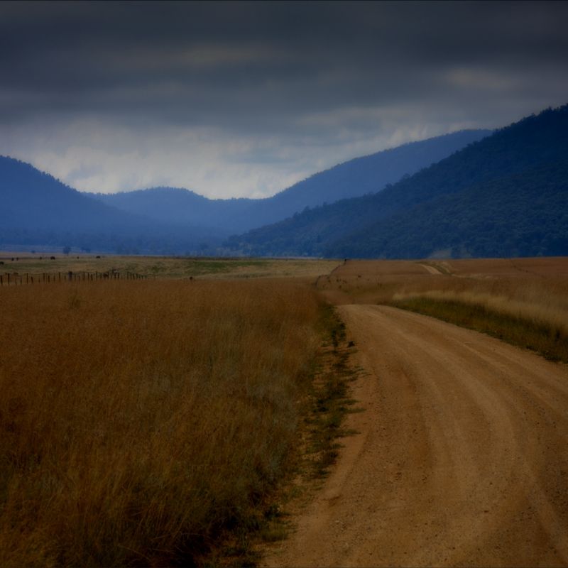
This image sums up the dirt roads across the mountains ... until you reach the snow grass country.
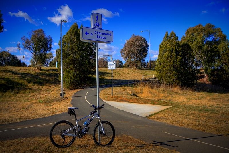
Your idea of traveling into the Blue Mountains (supported by Spoonie), is a good one. You can join the BNT at Rydell Railway Station. The BNT goes right past the station or just follow the quiet country roads through places like Mount Rae and Rosalind through to beautiful Lerida and across the top of the Lake George Escarpment (Marked Tree Road) to Gundaroo and then cross Canberra from Mulligan's Flat on the cycle paths. Have a look at Mulligans Flat wildlife enclosure if you haven't seen it, I fully recommend this side trip.
View from Marked Tree Road.
The Trunk Road at Mulligan's Flat is like billiard table surface and the Old Coach Road to return on, is just as good ... but more rustic looking.
A sign to the Charny Shops is a cycle path sign to nowhere. I don't know if you have ridden Canberra's cycle paths or on the on-road cycle lanes, they are a gift despite the signage.
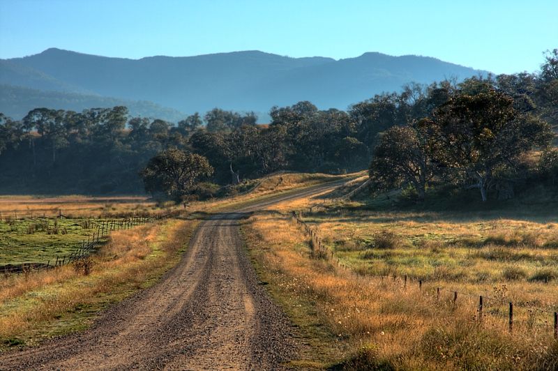
These are just a few options for crossing the Northern Alps, if coming through Canberra becomes an option. I know the tarmac roads and the dirt tracks and fire trails in my district ... the dirt is very classy. Sorry I don't have web maps the SE, it is in my head. High quality well maintained fire trails and back country roads here are all little visited by touring cyclists. On the dirt there are very few vehicles to contend with, if any at all ... unlike the few tarmac roads which channel heavy traffic. There are so many options on the dirt, and not many on the tarmac.
I hope this helps. Good luck and have a good adventure.
Warren.
Last edited:
Lord Flog, G'day.
The Topeak MTX Beam Rack, is good, it does the job well. I bought the side rails separately, they don't come with the rack. $90 for the rack and $50 for the pair of rails. I don't have a slide-on rack box.
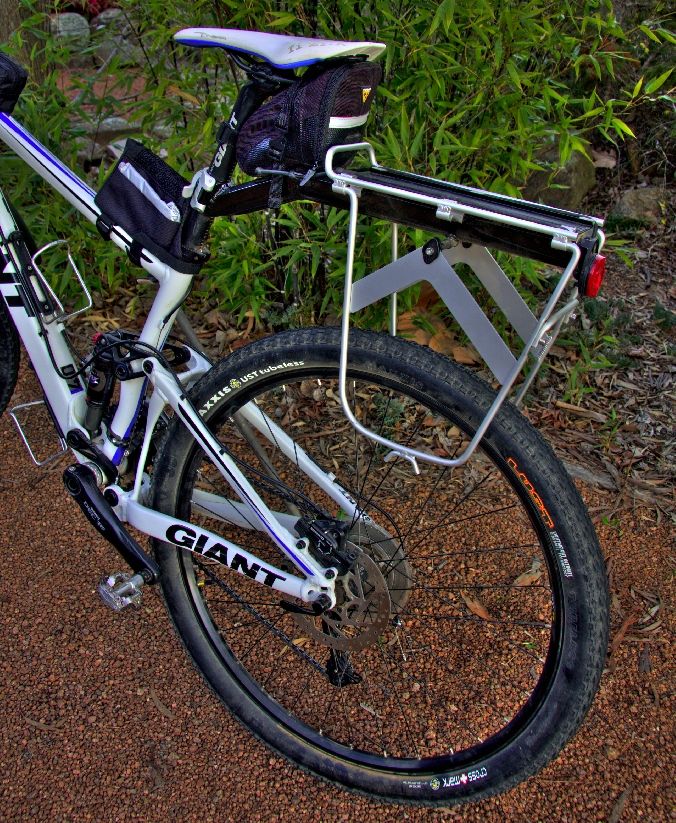
When I first installed the MTX Beam Rack it was prone to swaying back and forth when carrying stuff. What seemed to be secured tightly enough, wasn't tight enough.
I cleaned the rubber shims with acetone to remove the mold silicons and scuffed up the rubber with #300 wet and dry and also cleaned the seat post with acetone. This has helped the mechanism to grip tighter and more securely around that seat post. Since doing this about 2 years ago, it has been fine. If you have a carbon seat post, think about using another type of cleaner, acetone can dull the surface of composite materials.
The rack's maximum carry weight is 9kg. I only carry about 8kg, which includes the weight of the rack and the side rails. The lighter the load carried the better of course. The rack with the side rails is only about a kg.
Would I buy a beam rack again? ... no worries because I don't throw the bike around. The rack suits slower riders.
If you ride hard, you would want a rack that mounts on the stays ... on a duelly.
Warren.
The Topeak MTX Beam Rack, is good, it does the job well. I bought the side rails separately, they don't come with the rack. $90 for the rack and $50 for the pair of rails. I don't have a slide-on rack box.
When I first installed the MTX Beam Rack it was prone to swaying back and forth when carrying stuff. What seemed to be secured tightly enough, wasn't tight enough.
I cleaned the rubber shims with acetone to remove the mold silicons and scuffed up the rubber with #300 wet and dry and also cleaned the seat post with acetone. This has helped the mechanism to grip tighter and more securely around that seat post. Since doing this about 2 years ago, it has been fine. If you have a carbon seat post, think about using another type of cleaner, acetone can dull the surface of composite materials.
The rack's maximum carry weight is 9kg. I only carry about 8kg, which includes the weight of the rack and the side rails. The lighter the load carried the better of course. The rack with the side rails is only about a kg.
Would I buy a beam rack again? ... no worries because I don't throw the bike around. The rack suits slower riders.
If you ride hard, you would want a rack that mounts on the stays ... on a duelly.
Warren.
Last edited:
Thanks for that. I've been considering the options for how to carry more gear (food & water) - especially with a dually frame. I've made frame bags for my hard tail (thanks for lending me yours to copy Pill Wizard) but am interested in using the dually for longer rides and the inside bag in particular won't work with it.
Given that I'm not an overly energetic pedaller, the time between re-stock points could be an issue for some of the routes I've been looking at.
Thanks also for the pictures and dialogue from some of your tours. It's providing some inspiration.
Given that I'm not an overly energetic pedaller, the time between re-stock points could be an issue for some of the routes I've been looking at.
Thanks also for the pictures and dialogue from some of your tours. It's providing some inspiration.
DaGonz
Eats Squid
http://freeload.co.nz/Thanks for that. I've been considering the options for how to carry more gear (food & water) - especially with a dually frame.
orderable through your local firendly bike store via Dirt Works, or I guess directly online...
Cheers
Spoonie