Frosty2086
Likes Bikes
24/1/07
Have recently had some more time to get down and do some building, currently working on a seasaw/drop combination for a slightly more difficult route in the skills park. Have built the small (1-2ft) drop, and half done the burm leading into the seasaw, thanks to my canadian mate who came out digging yesterday. Turns out even non-riding canadian have trail building in their blood, he is a burm building machine! Also have completed the on ramp to the sea saw, which is looking soooo stiff, very happy with how it came out. The sea saw is next, and will be doing some work on that today hopefully, it will be made with a huge log the is sawn in half, about 2ft wide and around 9ft long...i will put a detailed construction post in here once im done incase anyone is intrested. To finish the rest of this section we are thinking of puting in another nice burn and a dirt rollercoaster....anyways here is the pics of yesterdays work!!

A canadian doing what they do best....

More candian burm action!

Small drop coming off existing trail..

The intial ramp supports, and holes, each about 1ft deep (soil packs really well so going deeper on this occasion was a bit of over kill)

The finished product, the seasaw will come of this ramp...

And me, the proud builder of my first NS ramp....
3/1/07
Ok, so i thought i had edited this and put the location etc in, but it turns out i didnt which is annoying because now i have to do it again!
So the trail is located in Mandeni Park, its on the web at http://www.mandenigolf.com.au/ which inculded directions, and fees etc. As it stands on your own bike its $2 a day, or $10 for the year!! Any questions just send us a pm and id be happy to help, or go for a ride!! When i get onto work up in the more downhill area i will keep you posted, but have been busy at work etc. over christmas new year!! Anyways happy riding!!
18/12/06
Alright,
recently i have been involved in the construction of some new trails around my area. These trails are on private land but when completed will be open to the genral public for a minimal fee per day (to cover insurance very tentatively around $2...and $10 for the year). So what i though i would do is put up a selection of photos of some of the work we have being doing. The XC loop is now just about complete and i am going to (hopefully) start work on the freeride trail in the new year. So I thought if i could run a log of work it would be awesome to get feedback on stunts, what you like/dislike and just expand my resources to draw from, as this would be my first ever free ride trail. Anyways, here is some higlights from the cross country loop which will be opened very very soon....
XC Loop Higlights

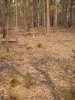
Flowy single track along the creek line.

Near the creek line entry, bridge over fence.

More of the creek line section

Ladder bridge over creek

Another fence crossing

Downhill single track section near quarry

Entry to a log ride

Ladder bridge over log

Another log ride

mmm..single track

Trail master 3000...

Burms....

Log ride down ramp

More single track
Ok, So in response to the questions as to where is it, i will let you know the exact location, and how to get their, and post up a trail map probably on thursday. The owners dont want the location exposed until the whole thing is fully ready to ride, with signage etc. But it is on the south coast of New South Wales, and with a bit of looking at my past posts you may be able to narrow that down further") ! The trail i would say is moderately difficult depending on the section, its aimed at all skill levels hence why the log rides etc are their to challenge some people. Its around an 8km loop and has great infrastructure for races. eg. toilets camping areas, hostel, cabins all contained in the property, and has some more technical sections. Their are also plans in to expand the loop to include a really sweet technical section a couple of km's long for races etc....So watch this space for exact locations!!
! The trail i would say is moderately difficult depending on the section, its aimed at all skill levels hence why the log rides etc are their to challenge some people. Its around an 8km loop and has great infrastructure for races. eg. toilets camping areas, hostel, cabins all contained in the property, and has some more technical sections. Their are also plans in to expand the loop to include a really sweet technical section a couple of km's long for races etc....So watch this space for exact locations!!
Freeride/Downhill
Alright so this part of the trail system is going to be aimed at a more gravity feed style of riding. However the largest vertical drop i have access to at the moment is around 60m. This drops over around 600m, and then travels out a creek line to the finish of the trail. However we are currently trying to gain access to the continuation of the hill i am working on which will give us around 100-200 metres of vertical, over a couple of km.

This is the trail map thus far, the creek line which it runs into will eventually be the route to take riders back to the finish of all the trails, and the up hill ride or shuttle back to the top. Each number sorresponds to a stunt of some description, with the photos being of each stunt location.

Location #2
This is going to be a step down/gap from the top log to the lower log. Not sure wheter a NS wood ram or dirt ram would be better, probably will go for wooden ramp.

Location #3
Rock outcrop which will have some small drops (1-2ft) and maybe a rock garden in it.
Location #4
No pics, but is large open area, thinking either a larger double, or a step up to table to with drop at end...im sure theirs a porper name for those stunts, but i dont know it.

Location #5
Large log ride from one log to the next will be ramp onto second log and will be either flatened of, or planked so you can gets lots of speed for the next stunt.

Gap jump over creek, will be around 10+ ft i imagine with dirt kicker, which is already half shaped, hard to see in pic, by nature.

This log will feed into a small NS section to get over a bunch of jumbled logs, etc.

Location #8
Start of the lower large NS section to get over the myriad of creeks and logs and prevent the total degredation of this area.

Looking from location #8 to #9 Down main creek line.

Location #9
Large log ride over creek, its around 30+ ft and has a reasonable drop either side of around 7+ft.

Location #9
View down trail, towards creek intersection, trail with zigzag along and over creek, with bits and pieces, like drops and seasawa thrown in where neccersary.

Location #9
View up trail, where you will come from, trail will wind down creek line.
The rest of the trail is un mapped an un-photgraphed, but it will make its way through a very shady, almost tropical crrek line, using features along the way for around anothe 500m to 1km....
Ok then, thats just about wraps up the log for the last couple of weeks, hoefully construction will start in the new year of the downhill/freeride area, with fingers crossed we can gain access to the rest of the hill behind the property to give us a larger trail. All feedback is very very much appreciated, i know i havent really done any building yet, but ideas etc are always welcome. PM if you want to help out/go for a ride......
cheers
Have recently had some more time to get down and do some building, currently working on a seasaw/drop combination for a slightly more difficult route in the skills park. Have built the small (1-2ft) drop, and half done the burm leading into the seasaw, thanks to my canadian mate who came out digging yesterday. Turns out even non-riding canadian have trail building in their blood, he is a burm building machine! Also have completed the on ramp to the sea saw, which is looking soooo stiff, very happy with how it came out. The sea saw is next, and will be doing some work on that today hopefully, it will be made with a huge log the is sawn in half, about 2ft wide and around 9ft long...i will put a detailed construction post in here once im done incase anyone is intrested. To finish the rest of this section we are thinking of puting in another nice burn and a dirt rollercoaster....anyways here is the pics of yesterdays work!!
A canadian doing what they do best....
More candian burm action!
Small drop coming off existing trail..
The intial ramp supports, and holes, each about 1ft deep (soil packs really well so going deeper on this occasion was a bit of over kill)
The finished product, the seasaw will come of this ramp...
And me, the proud builder of my first NS ramp....
3/1/07
Ok, so i thought i had edited this and put the location etc in, but it turns out i didnt which is annoying because now i have to do it again!
So the trail is located in Mandeni Park, its on the web at http://www.mandenigolf.com.au/ which inculded directions, and fees etc. As it stands on your own bike its $2 a day, or $10 for the year!! Any questions just send us a pm and id be happy to help, or go for a ride!! When i get onto work up in the more downhill area i will keep you posted, but have been busy at work etc. over christmas new year!! Anyways happy riding!!
18/12/06
Alright,
recently i have been involved in the construction of some new trails around my area. These trails are on private land but when completed will be open to the genral public for a minimal fee per day (to cover insurance very tentatively around $2...and $10 for the year). So what i though i would do is put up a selection of photos of some of the work we have being doing. The XC loop is now just about complete and i am going to (hopefully) start work on the freeride trail in the new year. So I thought if i could run a log of work it would be awesome to get feedback on stunts, what you like/dislike and just expand my resources to draw from, as this would be my first ever free ride trail. Anyways, here is some higlights from the cross country loop which will be opened very very soon....
XC Loop Higlights
Flowy single track along the creek line.
Near the creek line entry, bridge over fence.
More of the creek line section
Ladder bridge over creek
Another fence crossing
Downhill single track section near quarry
Entry to a log ride
Ladder bridge over log
Another log ride
mmm..single track
Trail master 3000...
Burms....
Log ride down ramp
More single track
Ok, So in response to the questions as to where is it, i will let you know the exact location, and how to get their, and post up a trail map probably on thursday. The owners dont want the location exposed until the whole thing is fully ready to ride, with signage etc. But it is on the south coast of New South Wales, and with a bit of looking at my past posts you may be able to narrow that down further
! The trail i would say is moderately difficult depending on the section, its aimed at all skill levels hence why the log rides etc are their to challenge some people. Its around an 8km loop and has great infrastructure for races. eg. toilets camping areas, hostel, cabins all contained in the property, and has some more technical sections. Their are also plans in to expand the loop to include a really sweet technical section a couple of km's long for races etc....So watch this space for exact locations!!Freeride/Downhill
Alright so this part of the trail system is going to be aimed at a more gravity feed style of riding. However the largest vertical drop i have access to at the moment is around 60m. This drops over around 600m, and then travels out a creek line to the finish of the trail. However we are currently trying to gain access to the continuation of the hill i am working on which will give us around 100-200 metres of vertical, over a couple of km.
This is the trail map thus far, the creek line which it runs into will eventually be the route to take riders back to the finish of all the trails, and the up hill ride or shuttle back to the top. Each number sorresponds to a stunt of some description, with the photos being of each stunt location.
Location #2
This is going to be a step down/gap from the top log to the lower log. Not sure wheter a NS wood ram or dirt ram would be better, probably will go for wooden ramp.
Location #3
Rock outcrop which will have some small drops (1-2ft) and maybe a rock garden in it.
Location #4
No pics, but is large open area, thinking either a larger double, or a step up to table to with drop at end...im sure theirs a porper name for those stunts, but i dont know it.
Location #5
Large log ride from one log to the next will be ramp onto second log and will be either flatened of, or planked so you can gets lots of speed for the next stunt.
Gap jump over creek, will be around 10+ ft i imagine with dirt kicker, which is already half shaped, hard to see in pic, by nature.
This log will feed into a small NS section to get over a bunch of jumbled logs, etc.
Location #8
Start of the lower large NS section to get over the myriad of creeks and logs and prevent the total degredation of this area.
Looking from location #8 to #9 Down main creek line.
Location #9
Large log ride over creek, its around 30+ ft and has a reasonable drop either side of around 7+ft.
Location #9
View down trail, towards creek intersection, trail with zigzag along and over creek, with bits and pieces, like drops and seasawa thrown in where neccersary.
Location #9
View up trail, where you will come from, trail will wind down creek line.
The rest of the trail is un mapped an un-photgraphed, but it will make its way through a very shady, almost tropical crrek line, using features along the way for around anothe 500m to 1km....
Ok then, thats just about wraps up the log for the last couple of weeks, hoefully construction will start in the new year of the downhill/freeride area, with fingers crossed we can gain access to the rest of the hill behind the property to give us a larger trail. All feedback is very very much appreciated, i know i havent really done any building yet, but ideas etc are always welcome. PM if you want to help out/go for a ride......
cheers
Attachments
-
 171.5 KB Views: 101
Last edited: